 Ivan D. Zolnikov1,2,3,*, Anastasiya V. Nikulina3,**, Konstatin K. Pavlenok3,***, Anton V. Vybornov3,****, Aleksandr V. Postnov3,*****, Dmitry A. Bychkov3,******, Nadezhda V. Glushkova1,2, ******
1Sobolev Institute of Geology and Mineralogy, the Siberian Branch of the RAS, Novosibirsk, Russia
2Novosibirsk State University, Novosibirsk, Russia
3Institute of Archaeology and Ethnography, the Siberian Branch of the RAS, Novosibirsk, Russia
*E-mail: zol@igm.nsc.ru
**E-mail: nikulina_a@ngs.ru
***E-mail: pavlenok-k@yandex.ru
****E-mail: vybornov@archaeology.nsc.ru
*****E-mail: postnov@yandex.ru
******E-mail: bda.nsk@yandex.ru
*******E-mail: hope@igm.nsc.ru
Keywords: Western Siberia, Tomsk Region, GIS, spatial analysis.
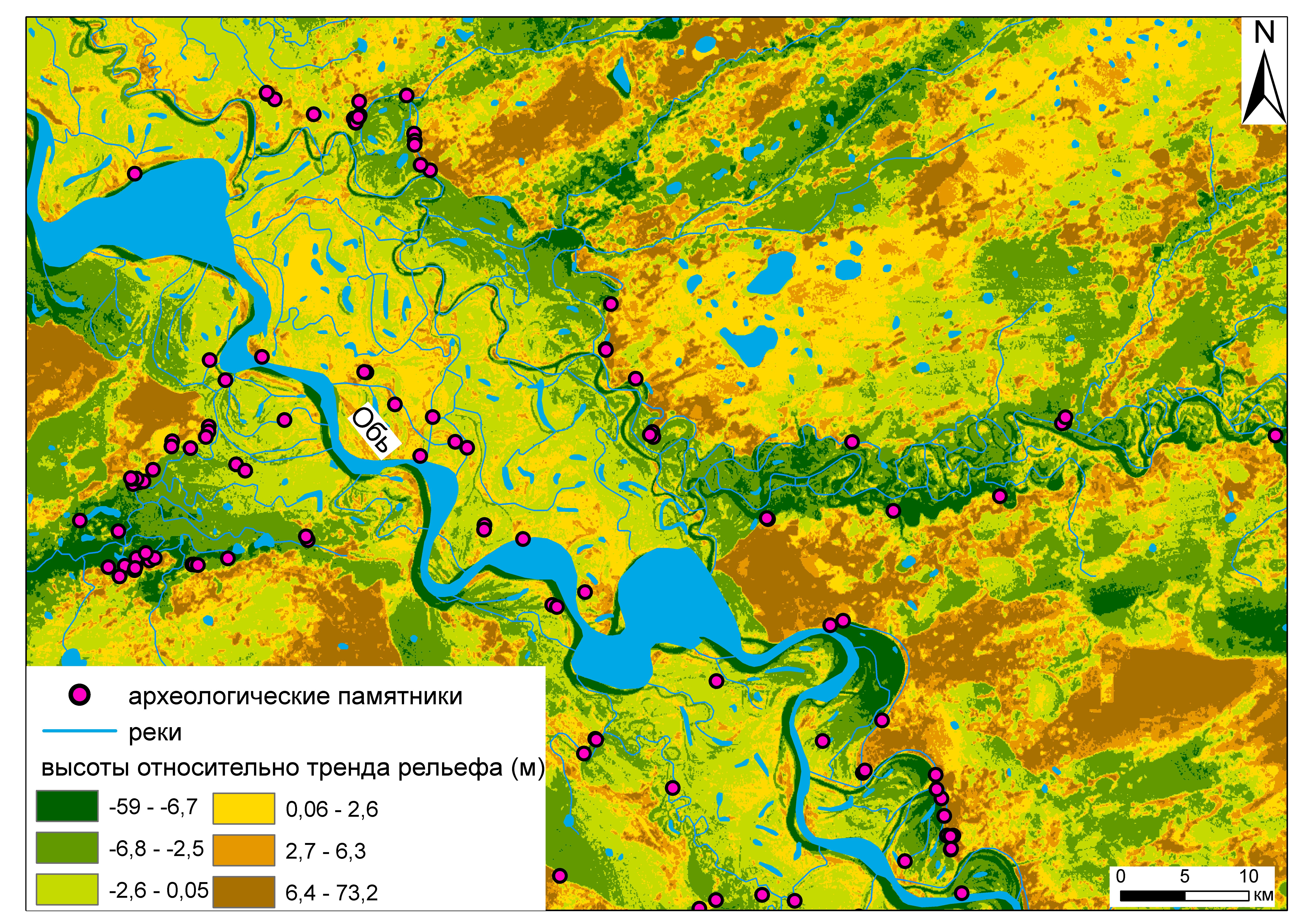
The article presents a survey research based on a regional GIS project aimed at studying archaeological sites of Tomsk Region. The spatial analysis of the sites revealed that the spatial distribution of archaeological objects is similar to the location of modern settlements. The specific area of swamps in the territory surrounding the site is a factor affecting the localization of archaeological sites. In general, sites tend to be situated near riverbeds; most of the sites located on the watersheds are confined to the baulk of the erosion terraces on the edges of river valleys, which the riverbeds bank against. The nature of the site distribution does not depend on the available information on the territory; it is only the density of distribution of archaeological objects that changes. Therefore, the revealed patterns are most likely predetermined by the preferences of the ancient population, and not by the factors of accessibility and certainty of knowledge.
DOI: 10.31857/S086960630008251-5