

 Anastasia V. Nikulina1,*, Ivan D. Zolnikov2,3,**, Olga I. Novikova2,***
1Leiden University, Netherlands
2Institute of Archaeology and Ethnography SB RAS, Novosibirsk, Russia
3V.S. Sobolev Institute of Geology and Mineralogy SB RAS, Novosibirsk, Russia
*Email: nikulina1302@gmail.com
**Email: zol@igm.nsc.ru
***Email: novikovolga@yandex.ru
Keywords: GIS, landscape archaeology, Western Siberia, paleolandscape, site catchment analysis, the Holocene.
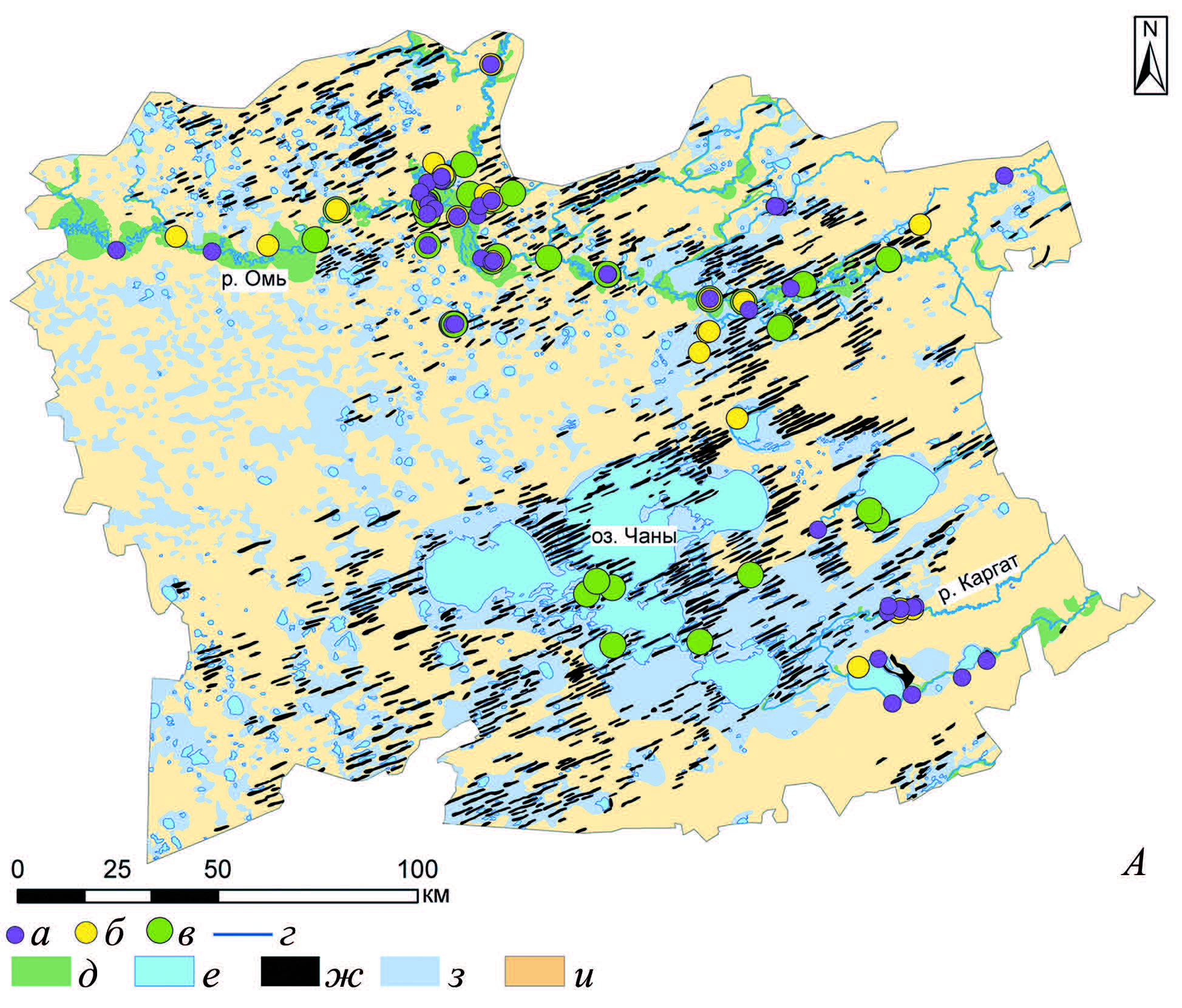
This article is devoted to site catchment analysis of settlements occupied during the Middle – Late Holocene in the central part of the Baraba Lowland (Baraba steppe). In accordance with existing theory, buffer zones with different radii were built around each settlement. The proportion of river valley area was calculated within each buffer zone. River valleys took the biggest part of zones during the periods of dry climate, while during the periods of increased moistening the percentage of gently rolling plain within zones grew. Zones of 1 km radius were more important for all populations than zones of 5 km and 10 km radii under dry conditions. A high proportion of river valleys within zones did not determine choices of settlement location under moderate climate conditions. Population occupied areas with meadows (not bogged and not flooded lands) used for animal husbandry during the periods of wet and very wet conditions, however, foragers settled close to rivers. Thus, during the Middle–Late Holocene, populations in the study area had paleolandscape preferences mainly determined by climatic conditions and economic system. The data obtained can be applied for other regions characterized by similar paleolandscapes.
DOI: 10.31857/S086960630013703-2


 gardens in Darvaz")
")
